I’m pretty much recovered from some surgery now and thoughts are turning, as ever, to getting back on the water and catching some fish. Okay, so I’m suffering a severe bout of cabin fever but the weather is so severe here on the East Anglian coast right now that I couldn’t get out to fish even if I was fit. I spent an hour on the phone last night with a friend who runs one of the local charter boats last night and he’s also stuck in port…it seems that we’re all having an enforced month off. It’s not the worst time to be stuck inside of course, this time of year sees a lull as the cod move off to spawn in deeper water before the, they smoothounds and bass start to move in for the crab moult, our eight legged, two-pincered friends also heading inshore. So we’ve all been spending our time (and money) on maintenance and preparation. All my paddling gear is clean, all my fishing gear is serviced and rationalised and all my bait is tucked away into the freezer – frozen black lugworm for the spring cod run and 10kg of unwashed loligo squid for those and the smoothound, ray and early bass. I’m ready. Oh, there’s still a full freezer tray of fish to eat too…
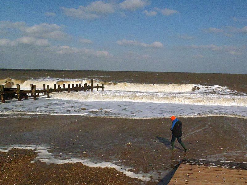
But what about this weather? Well, it’s being blowing onshore for a week or two with no let up just yet, strong blows too, force six plus most days, and this has really hit the coastline. Erosion has been front page news and with cliffs crumbling, sea defences taking a battering and sand being washed away as the beaches are scoured are going to make everything quite different on my return to the water. Further out I’ve heard reports that the main mark I’ve been heading for over the last twelve months is now a snaggy area of rough ground with all the junk dumped there in the days of the Lowestoft fishing fleet days becoming exposed. I’m told that the sidewinders and trawlers regarded it as a neutral area and hence they all used it so as to not snag the same obstructions the next time out. Everything from rope and chain to boulders was dumped over the side and so it became a natural haven, worked only by line fisherman…and now it’s all uncovered again. With the area around consisting of sandbanks and channels known as roads (Corton Roads, Yarmouth Roads and so on) and the charts marked as being prone to shifting sands this means that a lot of old marks such as rough ground, gullies, holes and banks is now going to be so much useless data as the seabed is totally changed; we’re talking about 30-40ft of water beneath us in these places, it doesn’t take a lot to change things.
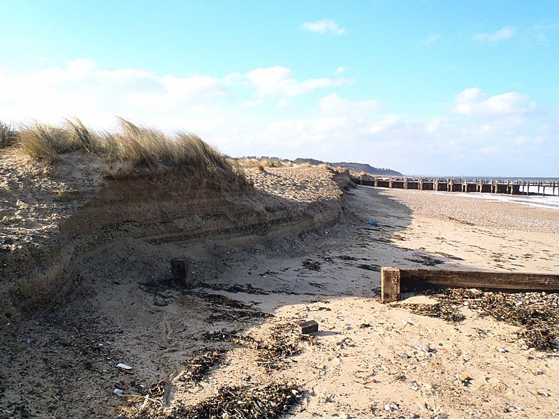
What interests me in the short term however is how the launch sites have fared and what changes we may see for the kayaks. Though I rarely fish from Lowestoft’s south beach I do surf kayak there whenever it’s big and use it to head south for wreck marks off Pakefield and Kessingland. Well, the glorious sandy beach of the summer is long gone, it’s a cut away shingle shoreline now and the surf pattern has changed yet again. The levels have dropped by a good 10-12ft here and it looks as though the banks have shifted somewhat, with luck some of them will have gone along with the shallower water that typifies this beach; the bay might become more fishable now.
Moving north the next launch site, the one we refer to as Dogger with tongue in cheek after some night sessions where the car park is always busy, has fared badly too, and more visibly. At least as far as erosion is concerned. The level of the beach has dropped a similar amount, more concrete from old sea defences has been uncovered to the south of the launch spot and the current high tide mark has shifted quite a way up to the beach, scouring a few feet out of the dunes. There’s a noticeable drop down over the wooden groyne to the sand now too, something that was often covered in sand…but for us at least it looks as though it may not all be bad news. Dogger is distinguished by having a heavy, and tall, dumping wave to launch and land through and one hell of a backwash that causes no end of problems at times…well it seems that the beach now having been flattened out may have become more friendly to us, the ridge and sudden drop having gone should see the water rolling up smoothly instead of rearing up and flinging us into a heap. I mean, we get wet launching and it’s always quite exhilarating and we all enjoying surfing back in but smashed rods, lost kit and fish that disappear into the waves is not all it’s cracked up to be.
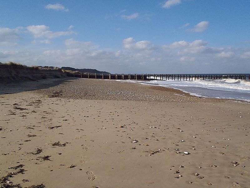
Next in line, a mile to the north, Is Corton, the launch at the bottom of Tramp’s Alley. Well, this appears for all intents and purposes to have been the least touched of the lot. The beach appears to have remained in-situ and the groynes have done their job. It’s quite steeply banked, relatively, and was largely stone anyway. Quite what’s happened to the snags that the beach anglers hate there I don’t know, probably worsened, but from a launching point of view it looks pretty much the same; I guess time will tell if the dumping waves have been taken away with the removal of the ridge or whether it’s just the same with a steep drop-off.
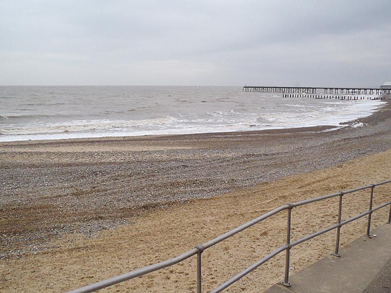
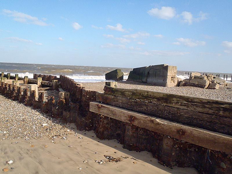
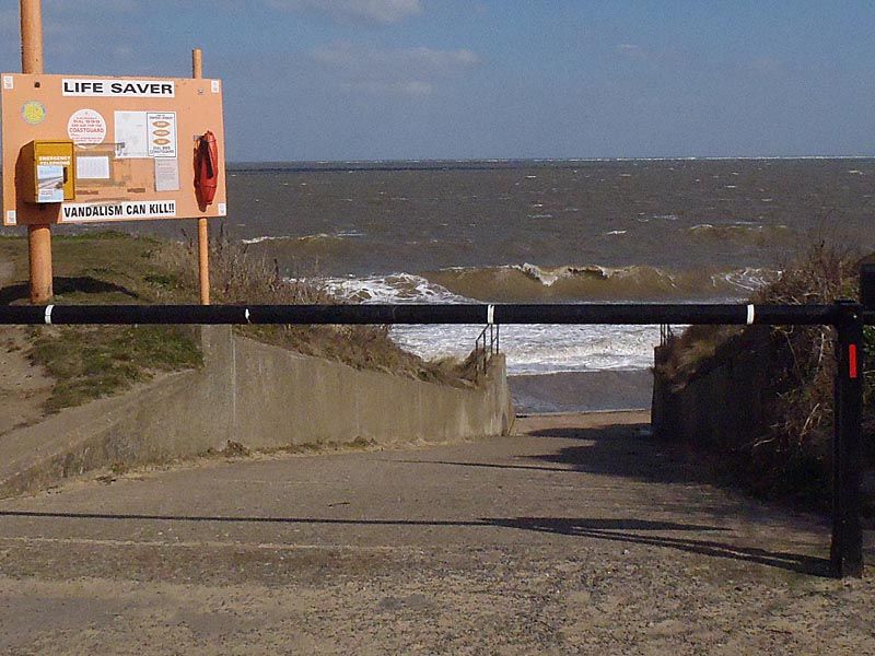
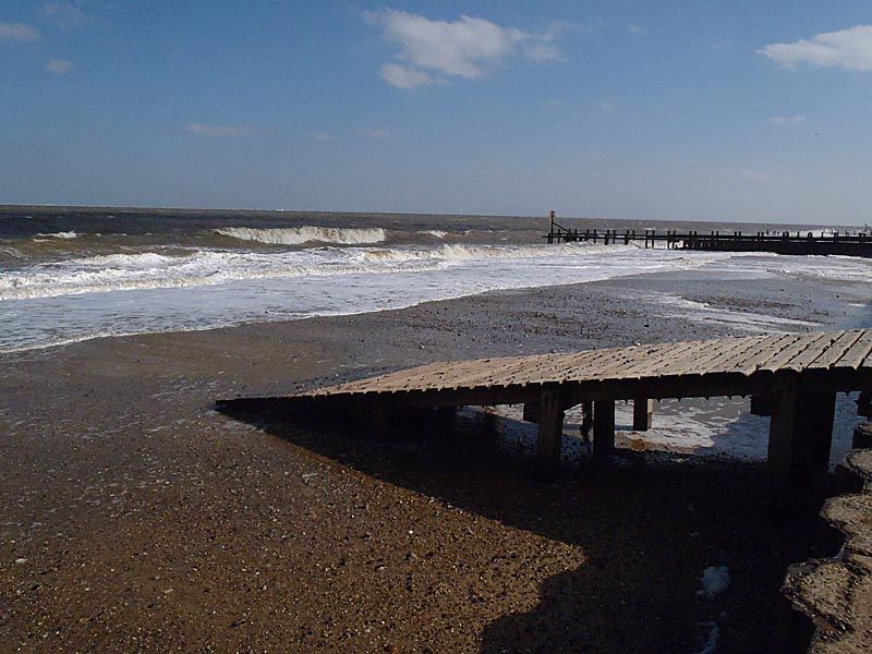
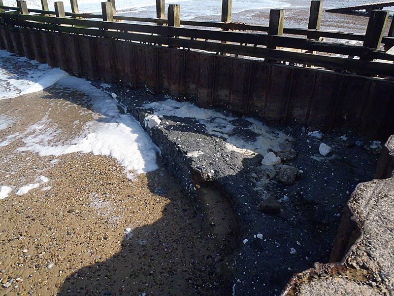
The last beach I’ve headed to, our main launch over the past five or six years, has fared the worst of all. Hopton changes a lot anyway, it’s very weather-dependant with easterlies taking sand and westerlies putting it back but this is severe. The concrete to the beach is now a good 7ft, the wooden ramp at the bottom of the slope is uncovered right to the bottom and there is rock exposed, especially around the groynes. I have never seen it like this. At high water there isn’t going to be any beach at all and how long this will last for is anyone’s guess. The power of these waves is clear from the photograph from the top of the slope.
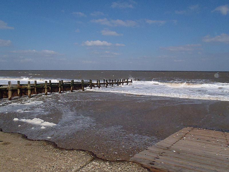
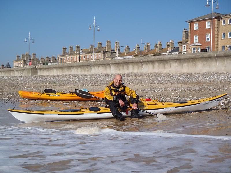
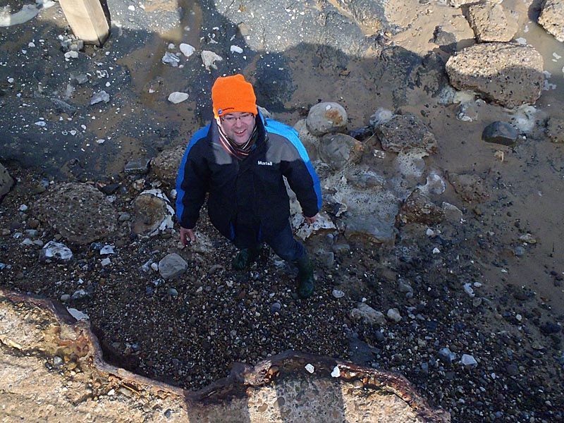
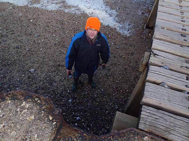
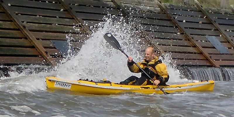
No, despite the hat this is not a gnome, this is a Si and he’s getting on for 6ft tall.
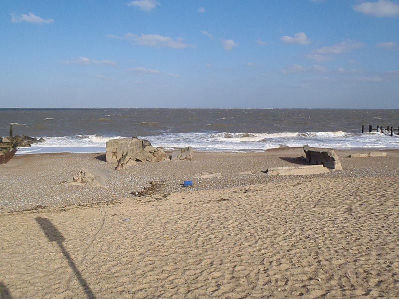
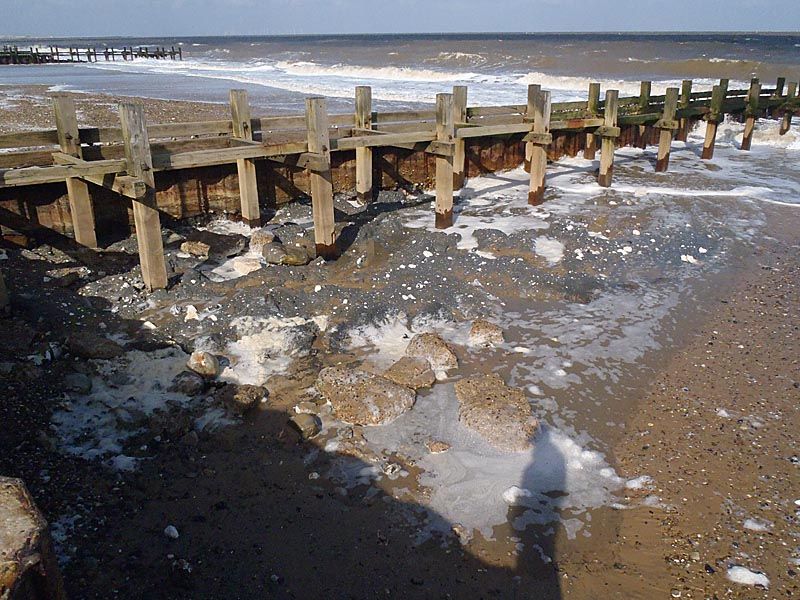
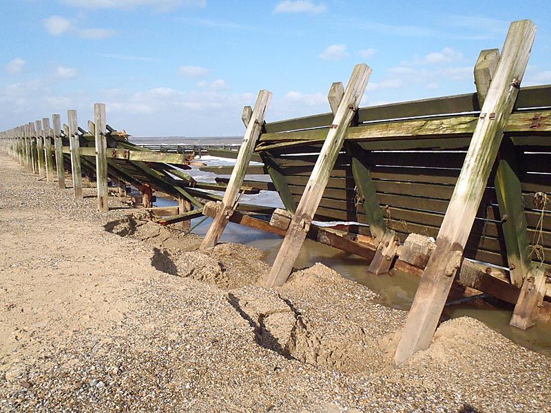
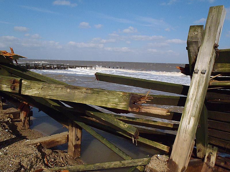
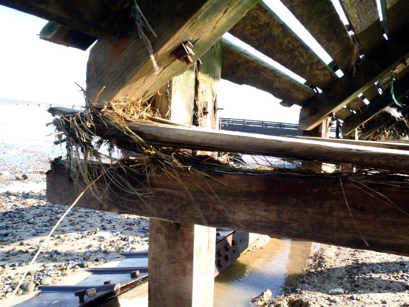
Walking north though there is a lot more of a tale to tell. We played here in the rebounding waves last summer, there was sand up to the point where the defences turned inwards on the seaward side. Not any more. Viewing platforms have been ripped off, the beach has been scoured out and flattened as well as losing tons of sand as the level has dropped and the water has come through and taken sand from behind; landslides from the cliffs, a pathway that has been cut short, chunks of concrete and metal pickets and even the roof of a pillbox that was completely buried not so long ago…and in many places the sand in which the defences are buried has been washed away and collapsed in on itself; in one place this has been so severe that the defences – we’re talking about wood a foot square – has been broken and fifty or more yards of sea wall has been pulled seaward. I could do little more than shake my head and keep muttering words like mental as I walked along. We don’t launch from this point but we have marks 200 and 400 yards out from here, and a fairly substantial shallow water wreck; I have no idea what’s going to be down there when I next get out.
And that’s where the fun will be. It’s a whole new coast for us.
No comments:
Post a Comment